Get widget

News

All kinds of news around the world in one place!

Studies

Explore with us and enjoy in that!

Encyclopedia

Start with us a journey through world of knowledge!

Travel

The world is beautiful. Let's peek into some magnificent places, and see what they offer!

Entertainment

Fun - because we have the right to be happy!

Lifestyle

Our life is adventure. Enjoy in every moment of that!

TOP 10

Amazing lists of incredible things!

Jerusalem, Israel


History
  • Early History to 1900

Despite incomplete archaeological work, it is evident that Jerusalem was occupied as far back as the 4th millenium B.C. In the late Bronze Age (2000–1550 B.C.), it was a Jebusite (Canaanite) stronghold. David captured it (c.1000 B.C.) from the Jebusites and walled the city. After Solomon built the Temple on Mt. Moriah in the 10th cent. B.C., Jerusalem became the spiritual and political capital of the Hebrews. In 586 B.C. it fell to the Babylonians, and the Temple was destroyed.

The city was restored to Hebrew rule later in the 6th cent. B.C. by Cyrus the Great, king of Persia. The Temple was rebuilt (538–515 B.C.; known as the Second Temple) by Zerubbabel, a governor of Jerusalem under the Persians. In the mid-5th cent. B.C., Ezra reinvigorated the Jewish community in Jerusalem. The city was the capital of the Maccabees in the 2d and 1st cent. B.C.

After Jerusalem had been taken for the Romans by Pompey, it became the capital of the Herod dynasty, which ruled under the aegis of Rome. The Roman emperor Titus ruined the city and destroyed the Temple (A.D. 70) in order to punish and discourage the Jews. After the revolt of Bar Kokba (A.D. 132–35), Hadrian rebuilt the city as a pagan shrine called Aelia Capitolina but forbade Jews to live on the site.

With the imperial toleration of Christianity (from 313), Jerusalem underwent a revival, greatly aided by St. Helena, who sponsored much building in the early 4th cent. Since that time Jerusalem has been a world pilgrimage spot. Muslims, who believe that the city was visited by Muhammad, treated Jerusalem favorably after they captured it in 637, making it the chief shrine after Mecca. From 688 to 691 the Dome of the Rock mosque was constructed.

In the 11th cent. the Fatimids began to hinder Christian pilgrims; their destruction of the Church of the Holy Sepulcher helped bring on the Crusades. Jerusalem was conquered by the Crusaders in 1099 and for most of the 12th cent. was the capital of the Latin Kingdom of Jerusalem. In 1187, Muslims under Saladin recaptured the city. Thereafter, under Mamluk and then Ottoman rule, Jerusalem was rebuilt and restored (especially by Sulayman I); but by the late 16th cent. it was declining as a commercial and religious center.

In the early 19th cent., Jerusalem began to revive. The flow of Christian pilgrims increased, and churches, hospices, and other institutions were built. Jewish immigration accelerated (especially from the time of the Egyptian occupation of Jerusalem by Muhammad Ali in 1832–41), and by 1900, Jews made up the largest community in the city and expanded settlement outside the Old City walls.

  • The Twentieth Century

In 1917, during World War I, Jerusalem was captured by British forces under Gen. Edmund Allenby. After the war it was made the capital of the British-held League of Nations Palestine mandate (1922–48). As the end of the mandate approached, Arabs and Jews both sought to hold sole possession of the city. Most Christians favored a free city open to all religions. This view prevailed in the United Nations, which, in partitioning Palestine into Arab and Jewish states, declared that Jerusalem and its environs (including Bethlehem) would be an internationally administered enclave in the projected Arab state. Even before the partition went into effect (May 14, 1948), fighting between Jews and Arabs broke out in the city. On May 28, the Jews in the Old City surrendered. The New City remained in Jewish hands. The Old City and all areas held by the Arab Legion (East Jerusalem) were annexed by Jordan in Apr., 1949. Israel responded by retaining the area it held. On Dec. 14, 1949, the New City of Jerusalem was made the capital of Israel.

In the Arab-Israeli War of 1967, Israeli forces took the Old City. The Israeli government then formally annexed the Old City and placed all of Jerusalem under a unified administration. Arab East Jerusalemites were offered regular Israeli citizenship but chose to maintain their status as Jordanians. Israel transferred many Arabs out of the Old City but promised access to the holy places to people of all religions. In July, 1980, Israel's parliament approved a bill affirming Jerusalem as the nation's capital. With suburbanization and housing developments in formerly Jordanian-held territory, Jerusalem has become Israel's largest city. Strife between Arabs and Jews persists. The issue of the status of East Jerusalem, annexed by Israel but regarded by Palestinians as the eventual capital of their own state, remains difficult. In 1998, Israel announced a controversial plan to expand Jerusalem by annexing nearby towns.


Overview

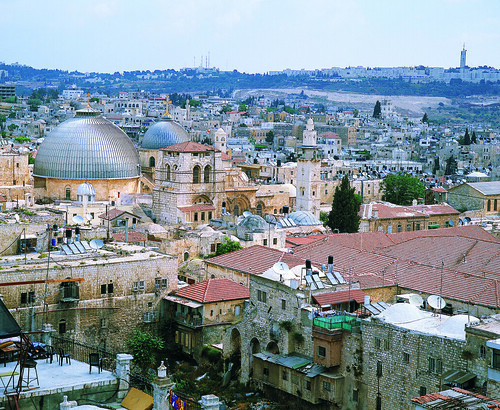
Few cities inspire as much passion as Jerusalem (Yerushalayim in Hebrew, Al-Quds in Arabic), rooted deep in the past and revered by three major religions.

With its pleasant, temperate climate, fine upland setting, extraordinary historical sites and world-class museums, Jerusalem fascinatingly contrasts ancient and modern, oriental and western.

The larger part of the city, including the city center with its shopping and leisure district, is vibrant, Jewish West Jerusalem, characterized by broad avenues, busy pedestrianized streets and squares, cafes, restaurants and vivacious nightlife. Smaller East Jerusalem, predominantly Arab, is a 19th-century neighborhood lying north of the Old City. It has a slow but chaotic pace of life, with crowded, colorful street markets.

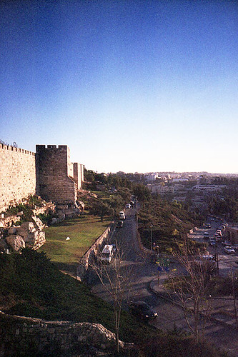
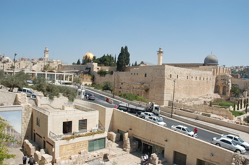
The Old City, on the eastern boundary, is where most of Jerusalem's main sights are found. Enclosed within awesome 16th-century stone walls, are a labyrinth of winding lanes where visitors to the city spend much of their time.

The Old City is divided into quarters, named after its four major communities in the 19th century: Arab, Jewish, Christian and Armenian, and preserving those sharp distinctions to this day. Within minutes, you may wander from calm squares where Jewish children play under the watchful eye of their mothers, to the hustle and bustle of an Arab souk, and into a tranquil Armenian garden, before arriving at the splendor of a medieval citadel.

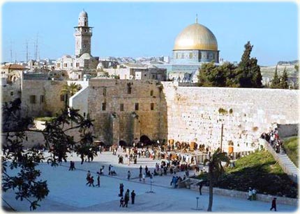
Jerusalem came into being over 3000 years ago as the site of the Jewish Temple. The Western (or Wailing) Wall at the foot of Temple Mount is all that survives of the Temple, destroyed by the Romans, yet it remains Judaism's most revered place of prayer.

Extensive restoration and archaeological exploration gives astonishing insight into the structure and layout of the vast Temple in the time of Jesus.

For Orthodox and Catholic Christians, the Church of the Holy Sepulchre encloses the site of the Crucifixion and tomb where Jesus was laid, having carried the cross here along the Via Dolorosa.

The Muslim's beautiful gilded Dome of the Rock on Temple Mount is Jerusalem's most iconic landmark, while Al-Aqsa mosque, beside it, is proclaimed Islam's third holiest shrine.

Israel declared Jerusalem its capital in 1950 but this is not internationally recognized. Most national institutions are in West Jerusalem, part of the state of Israel since the War of Independence following its creation in 1948. East Jerusalem and the Old City were first annexed by Jordan in 1948, then in 1967 by Israel, which integrated them into a reunited Jerusalem.


  • Sightseeing Overview

The compact size of Israel means that almost anywhere (with the exception of Eilat) is accessible for a day trip from Jerusalem. The coastal cities of Tel Aviv, Akko and Haifa, or the coastal ruins of ancient Caesarea, can easily be visited in a day, as can the area around the Sea of Galilee. There is enough to see in most of these places to merit a longer visit but, in terms of historical and religious sites, there is little to match Jerusalem.


The first stop for any visitor has to be the Old City, which contains the sacred sites that have caused such turmoil and unrest. It's divided into quarters (the Armenian, Christian, Jewish and Muslim) each with its unique identity and character.

When sightseeing or just exploring, visitors should be aware of the intense campaign of terrorism being waged against Israel. Popular crowded venues, such as busy street markets, restaurants and cafes, crowded buses, discos, have especially been targeted by suicide bombers.

Security guards have now been posted at the doorways or entrances to most such locations and it is advisable to be wary of venues that have not put any security measures in place. To date, tourist sights have not been struck by the bombers, and Arab areas or Muslim sites are of course unlikely to be hit.

Tourist Information
Israeli Government Tourist Office (IGTO)
Tourist Information Center, Jaffa Gate, Old City.
Tel: (02) 628 0382.
Website: www.jerusalem.muni.il
Opening hours: Sun-Thurs 0830-1545, Fri 0830-1245.

Passes
A two-day pass for the 99 bus, which gives a guided tour of the city, will allow discounted entry to the Israel Museum, Tower of David Museum and the Biblical Zoo. It can be bought at ticket offices at these sites or from the bus drivers (see Bus Tours in Tours of the City).

Key Attractions:

Temple Mount

Temple Mount (Har Habayit in Hebrew, Al Haram ash-Sharif in Arabic), also called Mount Moriah, is sacred to both Islam and Judaism. It is a natural hill, which was built up artificially to support the huge Jewish Temple that stood here for a thousand years in Biblical times. Temple Mount has remained the focus of the Jewish religion ever since - when praying, Jews worldwide still face Temple Mount.

It was from a black rock within the complex, that, according to the Koran, Muhammad made his ascension to Heaven at the conclusion of his dreamt ‘Night Ride' from Mecca, and, according to the Bible, it was here that Abraham offered Isaac for sacrifice. With the arrival of Islam in the seventh century, the octagonal, blue-tiled Dome of the Rock, with its huge gold dome, was built over the large black rock. Dominating the skyline of the Old City, its dome glinting in the sunshine, this beautiful building is Jerusalem's most famous landmark and an absolute must for visitors.

Also on Temple Mount is the Al Aqsa Mosque, the oldest mosque in Israel and (unlike the Dome of the Rock) an actual place of Muslim worship. Its silver dome dates from the 11th century. The Islamic Museum, the third building within the complex, contains Islamic artifacts and relics. Only one of the 10 gates to the complex, Al-Mughradia (Moors) gate, allows entry for non-worshippers. This is located to the right of the Western Wall and is accessed from Western Wall Plaza.

Access from Western Wall Plaza (Old City)

Website: www.al-aqsa.com (Muslim site) or www.templemount.org (Jewish site)
Opening hours: Closed during all prayer times (variable); otherwise Sun-Thurs 0730-1030 and 1230-1330; Sun-Thurs 0730-1030 (during Ramadan); closed to non-Muslims Fri and Muslim holidays. During periods of tension, the site may be closed.
Free admission for Temple Mount; charge for Dome of the Rock, Al Aqsa Mosque and Islamic Museum combined ticket.

Western Wall

Situated along one side of a vast plaza at the bottom of Temple Mount is the historic Western Wall (HaKotel in Hebrew). Also historically known as the Wailing Wall (a name offensive to some Jews) from the sounds of Jews chanting lamentations on Tisha b'Av, the annual fast, mourning the destruction of the Temple. The Western Wall, constructed of massive rough blocks of golden stone, is a remnant of the outer retaining walls of the Second Temple as reconstructed by Herod in 30BC (the First Temple, constructed by Solomon, occupied the same site but was destroyed by the Babylonians).

Since the final complete destruction of the Temple by the Romans in AD70, the Western Wall has been the holiest place of prayer for the Jewish people. Jews come from all over the world to pray or to contemplate. Some place notes with hopes, dreams and messages of goodwill in the cracks of the Wall. In keeping with Orthodox Jewish practice (because the entire site is technically an Orthodox synagogue) the length of the Wall has been divided into separate sections for men and women. Any man or woman may enter their respective section, provided men have their heads covered (visitors can borrow a kippah or skullcap when entering) and women are modestly dressed. The Wall can be reached either through the Dung Gate or through the Jewish Quarter of the Old City.

Western Wall Plaza (Old City)
Opening hours: Daily 24 hours.
Free admission.

Citadel or Tower of David

The tall, slender stone tower rising elegantly from the ancient walls of the Old City is almost as familiar an image of Jerusalem as the Dome of the Rock. But despite its name, the citadel has nothing to do with King David (the city's founder) and was in fact constructed in the first century BC, as a fortress for Herod the Great. It has therefore formed part of Jerusalem's defense structure for over 2,000 years. What remains today is largely medieval. It now houses the outstanding Museum of the History of Jerusalem, which vividly chronicles the entire history of the city. The Citadel's tallest tower, the Phasael, offers a superb panorama over the Old City. The main entrance is adjacent to Jaffa Gate.

Beside Jaffa Gate (Old City)
Tel: (02) 626 5333.
Website: www.towerofdavid.org.il
Opening hours: Sat-Thurs 0900-1700, Fri 0900-1400 (Apr-Oct); Sat-Thurs 1000-1600, Fri 1000-1400 (Nov-Mar).
Admission charge.

Via Dolorosa

The Via Dolorosa (literally ‘Road of Sorrow') is the route believed to have been walked by Jesus as he carried the Cross to his crucifixion at Calvary or Golgotha. The route begins at the Lion's Gate, passes through the Muslim Quarter and leads to the Calvary in the Church of the Holy Sepulchre. It is marked along the way by the 14 Stations of the Cross. The stations indicate events along the journey and at some of these points churches have been founded. Every year, tens of thousands of pilgrims walk this route in the belief that they are following in the footsteps of Christ.

Old City
Opening hours: Daily 24 hours.
Free admission.

Church of the Holy Sepulchre

Containing the last five Stations of the Cross of the Via Dolorosa, this is the holiest Christian site in Jerusalem. Upon entering the church, the little stairway to the right lead to the Chapel of Golgotha and three Stations of the Cross - where Jesus was stripped, crucified and removed from the cross. The Sepulchre itself is at the center of the church and marks where Jesus is believed to have been buried and resurrected. Downstairs is the Angel's Chapel, where the resurrected Christ made known himself to Mary Magdalene. The site of the church was first chosen in the fourth century by Queen Helena and the existing structure dates mainly from the period of the Crusades. It is divided into sections, which are each under the jurisdiction of a different Christian denomination. Protestants do not accept that this was the site of the Crucifixion or Resurrection.

Christian Quarter Road (Old City)
Tel: (02) 627 3314.
Opening hours: Daily 0530-2100 (summer); daily 0430-2000 (winter).
Free admission.

Yad Vashem

The name of this, the world's most important Holocaust memorial, means ‘A Hand and a Name', the word hand also meaning ‘memorial' and implying that every victim will be individually remembered. Yad Vashem (or the Holocaust Martyrs' and Heroes' Remembrance Authority) is located on the western edge of Jerusalem. It is best known as a monument to the devastation wreaked upon the Jewish people by the Nazis during WWII. There are indoor and outdoor exhibits, including museums, memorials, sculpture and a research and documentation center. The tree-lined Avenue of the Righteous Among the Nations commemorates and honors gentiles who risked their lives to save Jews and leads to the Historical Museum, Yad Vashem's prism-like central concrete structure lying mainly below ground, where the course of Hitler's ‘Final Solution' is traced.

The Hall of Remembrance is a solemn tent-like structure that allows visitors to pay their respects to the dead. Also contained within the Yad VaShem complex is the wooded, walled Valley of the Communities, recording the names of Jewish communities wiped out in their entirety, and the Hall of Names, where the names and details of over three and a half million individual victims have been recorded and are being constantly added to. There is also a poignant Art Museum, containing work produced by Jewish inmates of the death camps. Possibly the most moving, however, is the Children's Memorial, where, in a dark underground chamber, names from the list of 1.5 million children murdered in the Holocaust are constantly read out.

Har Hazikaron (near Mount Herzl, western edge of the city)
Tel: (02) 644 3400.
Website: www.yadvashem.org
Opening hours: Sun-Thurs 0900-1700 (2000 on Thurs), Fri 0900-1400.
No entry under 10 years old (including babies).
Free admission.

The Israel Museum

The Israel Museum is the nation's leading showcase for its archaeology, anthropology and art. It houses a vast number of fascinating exhibits relating to the long history and culture of the Jews in the region. Among the highlights are the modern sculptures of the Art Garden, the 20th-century artworks of the Art Pavilion, and the Archaeological Galleries, where major discoveries are displayed. In the Ethnography and Judaica wing, exhibits include a collection of ancient Jewish artifacts. A Youth Wing features hands-on activities for families and art classes for children.

The museum's greatest treasure is contained in a striking separate building called the Shrine of the Book. Resembling the lid of an earthenware jar, this structure was created to hold and display the Dead Sea Scrolls and other ancient manuscripts. Discovered beside the Dead Sea at Qumran in 1947, the Scrolls consist of the oldest known scripts of the Torah or Pentateuch (the first five books of the Old Testament), as well as the enigmatic scrolls of an austere, scholarly Jewish sect apparently resident at Qumran.

Ruppin Boulevard (near the Knesset, western edge of the city)
Tel: (02) 670 8811.
Website: www.imj.org.il
Opening hours: Mon, Wed, Sat and holidays 1000-1600, Tues 1600-2100, Thurs 1000-2100, Fri 1000-1400.
Admission charge.


Further Distractions:

Mount of OlivesItalic
Rising beyond the city walls, to the east of Temple Mount, the Mount of Olives is part of the range of hills surrounding Jerusalem. The olives that gave the place its name were cut down in Roman times and the western slope is now covered by the white tombs of the largest Jewish cemetery in the world. Tragically, it was badly vandalised during the Jordanian occupation (1948-1967), when the stones were smashed and defaced and many were removed to be used for construction. Among both Jews and Christians, the traditional belief is that the resurrection of the dead will begin on the Mount of Olives. The mountain has added religious significance for Christians, as the place Jesus came on the night before his arrest and trial. The Garden of Gethsemane, which Jesus visited after the Last Supper, lies at the foot of the slope. The supposed tomb of his mother, Mary, is a Byzantine and Crusader structure reached through a fine doorway that leads to an underground shrine containing various tombs. Although medieval, these are claimed to be the actual graves of Joseph and Mary and her parents. At the summit of the mount, an Arab village named Et-Tur affords a stunning panorama of the Old City.

Mount of Olives (East Jerusalem)
Opening hours: Daily 24 hours.
Free admission.

Montefiore Windmill Bold
Built by Anglo-Jewish philanthropist, Sir Moses Montefiore, in 1858, the windmill is one of the oldest and most famous landmarks outside the Old City. With the windmill and two rows of houses he set about establishing the first Jewish district outside the walls of the Old City, which he called Mishkenot Sha'ananim (peaceful dwellings), but which is now called Yemin Moshe. The windmill was damaged during the 1948 War of Independence, when the British attempted to blow it up. Today it has been restored by the Jerusalem Foundation, which plans to create an open air museum and visitors' center close by.

Yemin Moshe (West Jerusalem)
Opening hours: Sun-Thurs 0900-1600, Fri 0090-1300.
Free.


If you like this post just click here Posted By crkota with No comments

Mexican Alien Baby

Mexican TV revealed the almost unbelievable story - in 2007, a baby alien was found alive by a farmer in Mexico. He drowned it in a ditch out of fear, and now two years later scientists have finally been able to announce the results of their tests on this sinister-looking carcass.
At the end of last year the farmer, Marao Lopez, handed the corpse over to university scientists who carried out DNA tests and scans. He claimed that it took him three attempts to drown the creature and he had to hold it underwater for hours.
Tests revealed a creature that is unknown to scientists - its skeleton has characteristics of a lizard, its teeth do not have any roots like humans and it can
stay underwater for a long time.
But it also has some similar joints to humans. Its brain was huge, particularly the rear section, leading scientists to the conclusion that the odd creature was very intelligent.
But it has seemingly left experts stumped.


And in a further mystery, Lopez has since mysteriously died...
According to American UFO expert Joshua P. Warren (32), the farmer burned to death in a parked car at the side of a road.
The flames apparently had a far higher temperature than in a normal fire!
Now there are rumours that the parents of the creature Lopez drowned were the ones who in turn killed him out of revenge.
There are frequent UFO sightings and reports of crop circles in the area where the creature was found. Perhaps it was left behind deliberately by aliens.
Mexican UFO expert Jaime Maussan (56) was the first to break the story. He claimed it was not a hoax. Farmers also told him that there was a second creature but it ran away when they approached.

The puzzle has caused intrigue amongst BILD's readers. Some say it is a mutant, others wonder why aliens would leave a baby behind - and one reader asked why aliens don't wear clothes...


If you like this post just click here Posted By crkota with No comments

True story about Atlantis - the Bimini Road

The world is filled with mysterious sites, lost cultures, megalithic structures, sacred palaces and unusual occurrences that have stirred the imagination and led to speculation about our true origin. The Quest for Atlantis and the search for a forgotten ancient mother culture has intrigued and inspired generations of scientists, explorers, philosophers and psychics throughout the ages. The Quest for Atlantis is like the Holy Grail. It lies at the core of our traditions and contains the seed not only of mystery but of challenge. The term Atlantis stands as a metaphor for the human yearning to explore the unknown and to follow the path of truth wherever it may lead. The Atlantis legend credited to the Greek Philosopher Plato has endured and symbolizes a dream of a golden age, a lost paradise, and it could help explain similarities between ancient cultures, legends of worldwide floods, and megalithic construction in the Old and New World.
First accounts of Atlantis were supplied by Greek philosopher Plato in the 4th century BC. In Plato's dialogues Timaeus and Critias, Atlantis is described as a vast paradise in the great ocean beyond the pi!lars of Hercules.
For generations there was peace and the people were true and noble and they showed gentleness and wisdom. But at the end the Atlantean society began to decay, the divine wisdom began to weaken and fade and it became diluted with lawlessness, ambition and power.
During the last days of Atlantis, about 12,000 years ago, the Atlanteans had lost their virtue and were amassing armies to conquer the world when the Earth shook and the islands disappeared into the depths of the sea. Atlantis was a civilization unequalled before or since, yet it is said it vanished in little more than a single day, leaving not a trace behind.
In 1930, Edgar Cayce, one of America's most famous and well documented psychics, predicted that the remains of Atlantis would be found near Bimini in '68,'69. According to Edgar Cayce, many people living today are former Atlanteans, who are drawn back at this time to find Atlantis, to receive enlightenment and to help heal themselves and this ancient site from past turmoil. Edgar Cayce also predicted that a Healing Well could be found and developed into a centre for two purposes, regeneration for those with certain types of ailments, and a centre for archaeological research.
In 1612 an Indian legend was translated that described an island called "Bemene", where old people could bath and emerge young once more. Spanish explorer, Ponce de Leon, searched for "Bemene" and the fountain of Youth in vain. On "Bimini" a small spring has been discovered that contained some levels of lithium and sulphur, and where some people have reported an increase of well-being, euphoria and alleviation of certain ailments like arthritis.
Bimini glistens like a jewel in the azure Gulf Stream and is an enigma in many ways. Its layer of legends: Fountains of Youth, Atlantean remains, Healing Waters and Megalithic Stones all fuse in a dynamic crucible of energy and lore. Is Bimini part of the lost continent of Atlantis?
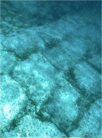
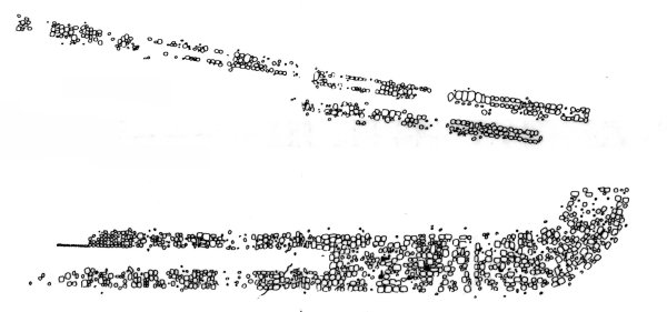
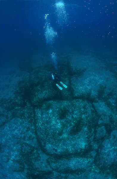
In September of 1968, on Bimini, a most exciting discovery was made. Dr Mason Valentine, zoologist, paleontologist, geologist, and underwater archaeologist was guided by Bonefish Sam to shore reef for some diving. When he looked down he saw hundreds of flat rocks eight to ten feet square arranged in regular patterns about a thousand yards from shore in about 10 feet of water. Today his discovery is called the „Bimini Road¾ and it is approximately 300 feet wide and 1600 feet long.
I was amazed to discern an extensive pavement of rectangles and occasionally polygonal flat stones of varying size and thickness, obviously arranged and accurately aligned to form convincing engineering courses. These stones had evidently been submerged over a long span of time for the edges of some had become rounded giving the blocks the appearance of giant loaves of bread or pillows. My personal feeling is that the whole fantastic complex represents the intelligent utilization by ancient man of material provided by nature and appropriate for the creation of some sort of ceremonial center.¾
After researching the area, Dr. Valentine has refuted the scientific claims that the road site is natural beach rock by explaining that many of the stones are of flint-hard micrite, unlike soft beach rock; that the stones do not follow the curving beach rock lines; that some of the enormous flat stones are propped up at the corners by pillar stones like dolmens and one end of the complex swings into a beautiful curved corner before vanishing under the sand. Dr. Valentine has studied the Bahamas for 30 years and has numerous sites for potential investigation. Dr. Valentine¼s discovery occurred precisely the time that Edgar Cayce had predicted that the remains of Atlantis would be found near Bimini.
Since that time many others have studied this amazing complex. Veteran French engineer, diver and pilot Dimitri Rebikoff, a pioneer of underwater photography and inventor of the Pegasus, an underwater platform, has carried out underwater and aerial photomapping of the Bimini Site. From 1969 to 1978, Dimitri Rebikoff has compiled a stereoscopic mosaic survey of the Bimini Road and continues to investigate the support pillars under some of the huge blocks.
In 1974 Dr. David Zink, prehistorian, and explorer came to Bimini to investigate the mysterious stones. Dr Zink has conducted extensive underwater surveying and archaeological work on Bimini that has included professional surveys, use of side-scan sonar and nuclear activation analysis. His scientific approach of exploring ancient mysteries has utilized U.S. Navy divers, as well as psychics in conjunction with standard archaeological practices. Dr Zink has led 10 expeditions to Bimini and is author of The Ancient Stones Speakand The Stones of Atlantis. More of Dr. Zink¼s discoveries are discussed in his revised 1990 edition of The Stones of Atlantis. Dr Zink has concluded the site was built by man as a megalithic temple similar to Stonehenge.
It has been 22 years since the discovery of the Bimini Road Site and much has happened. In the last two decades advances in technology, breakthroughs in consciousness and the greater understanding of the sophistication of prehistoric civilizations has occurred.
In 1989, Dr. Joan Hanley, founder of the Gaea Project, Dr David Zink and myself, came together and created Quest for Atlantis. We developed a conference with a multilevel approach that included on-site investigation, underwater exploration, aerial fly-bys and Healing Well experiences.
During the project, our group headed out for Paradise Point looking for the ancient stones in the vast ocean. Visibility was unlimited as our diving boat stopped and the divers and snorkelers entered the water. We were amazed at the incredible site we saw. Large regular boulders far more impressive than we had imagined, all fitted neatly in rows extending beyond our sight. Later during the conference while conducting aerial fly-bys with Dimitri Rebikoff as pilot, members of the flight observed a mysterious fish like mound over 500 feet long in the mist of the mangrove swamp. Although there were reports of a fish mound before it does not appear on any maps.
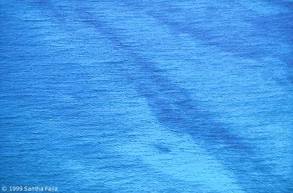
Enthusiasm was high as the group pondered the significance of a possible man made mound similar to the earthen works of the American Mound Builders on this remote island in the Bahamas. Later in the week we headed out for the Legendary Healing Well or possible Fountain of Youth. The ocean shimmered in various colors of unbelievable hues of blue as we left for the Northeast tip of the island. We arrived at a dense mangrove area and anchored in shallow water. A narrow path had been cut and we carefully waded through the root tangled path that led to a small pond.
The surface was warm sea water floating over that cool spring below. The water was abnormally buoyant and we floated effortlessly in the small pond. After getting used to the greenish water and the initial giggles, a peaceful feeling came over us. We meditated allowing the sense of well-being to spread and enfold our bodies. We left feeling emotionally balanced, and with a sense of profound peace.
After the conference, Raymond E. Leigh, a land surveyor commissioned a Miami aerial surveying firm to take infrared aerial photographs over Bimini at various heights. In the process of exploring the fish-mound from the air he discovered a rectangular mound and a cat mound. By conducting an in depth study of the mathematical data on Bimini, Raymond feels he has found similarities between ancient units of measurement. The fish fin has an east-west orientation. Calculations of the various dimensions of the mounds and painstaking analysis of the aerial photos revealed a recognition Golden Section (1 to 0.618) in the geometry of the Bimini Mounds.
In May 1990, Quest for Atlantis II again brought diverse expertise together. Dr. Joan Hanley, Dr. Doug Richards, zoologist and Director of Research for Atlantis University and myself created the second conference. Various explorers with diverse expertise attended. The conference focused on investigating mounds, a search for other wells and interviews with the elders of the island to preserve their stories and experiences.
The Quests were filled with adventure and opportunities in mind body and spirit to assimilate and integrate greater wholeness. The Quest is to touch something of the Divine and move from seeking to deep inner knowingness. The Quest stirs each generation. It asks us to remember and bring forth the truth about our spiritual and historical heritage. The time of revealing ancient records is dawning.
Old forms are giving way to new possibilities and the key to the new forms is in personal and group empowerment that include freedom and self-expression, integrity, interdependence, partnership, trust and action. We are all learning to understand the process of shared vision and right human relationship with ourselves, others and Mother Earth.
Mystery still surrounds the discoveries man made in ancient times and by others to be natural formation of beach rock, the Bimini Road Site has launched a multitude of questions and the controversy continues to this day. If these sites are not part of the sunken continent of Atlantis, they are very likely remains of some other ancient Old World Civilization and when identified will shed more light on our ancient past and who discovered the New World.
I know in my heart that the Healing Well is real and there is definite evidence of a very ancient culture in Bimini. There are many who have dedicated their lives and resources to research the evidence on this small island and there are many more to follow. The people drawn to Bimini and these projects are drawn together by a deep bond and a love of prehistory and Atlantis lore. The full realization of what the Lost Atlantean wisdom represents contains the seed of hope. Can we live together in harmony with universal energies? I know by bringing diverse disciplines and expertise together in a co-operative spirit we can help solve the mysteries and realize greater peace.
Today the possibilities of new discoveries as we search for the truth are limitless. It seems that mystery and imagination are vital in rediscovering the clues of the past. Paradoxically as science advances its storehouse of knowledge even more imagination and spirit are needed.¾ Albert Einstein in 1930.


If you like this post just click here Posted By crkota with No comments

Mary Celeste

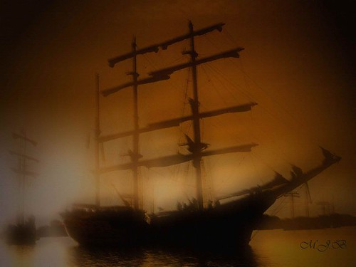
Mary Celeste was launched in Nova Scotia in 1860. Her original name was "Amazon". She was 103 ft overall displacing 280 tons and listed as a half-brig. Over the next 10 years she was involved in several accidents at sea and passed through a number of owners. Eventually she turned up at a New York salvage auction where she was purchased for $3,000. After extensive repairs she was put under American registry and renamed "Mary Celeste".

The new captain of Mary Celeste was Benjamin Briggs, 37, a master with three previous commands. On November 7, 1872 the ship departed New York with Captain Briggs, his wife, young daughter and a crew of eight. The ship was loaded with 1700 barrels of raw American alcohol bound for Genoa, Italy. The captain, his family and crew were never seen again...


Ship found adrift on December 4, 1872 (some accounts say December 5), by the Dei Gratia, a bark sailing from New York to Gibraltar, and considered by many one of the most intriguing and enduring mysteries in the annals of maritime history.

When it was found, the Mary Celeste was sailing itself alone across the wide Atlantic. The ship was in first-class condition. Hull, masts, and sails were all sound. The cargo-barrels of alcohol were still lashed in place in the hold. There was plenty of food and water. When he examined the ship's log, the captain of the Dei Gratia found that the last entry was on November 24. That would have been 10 days earlier, when the Mary Celeste had been passing north of St. Mary's Island in the Azores — more than 400 miles west of where it was found. If it had been abandoned soon after that entry, the ship must have drifted unmanned and unsteered for a week and a half. Yet this could not have been. The Mary Celeste was found with its sails set to catch the wind coming over the starboard quarter: in other words, it was sailing on the starboard tack. The Dei Gratia had been following a similar course just behind. But throughout the 400 miles from the Azores, the Dei Gratia had been obligated to sail on the port tack. It seems impossible that the Mary Celeste could have reached the spot it did with its yards and sails set to starboard. Someone must have been working the ship for at least several days after the final log entry.

No one, from the 10 people that supposedly sailed aboard the Mary Celeste, including 7 crewmen and captain Benjamin Briggs' wife and daughter, was ever found.

The explanation that seemed most reasonable at the time was the official one put out by the British and American authorities. This suggested that the crew had got at the alcohol, murdered the captain and his family, and then somehow escaped to another vessel. But the story does not really stand up. There were no visible signs of a struggle on board, and if the crew had escaped, some of them would surely have turned up later.

The Dei Gratia sights the abandoned Mary Celeste.

The yawl boat — a small four-oared boat carried over the main hatch — was missing, suggesting that at least some of the missing people could have left the Mary Celeste in it.

Dozens of theories have been put forward since then, ranging from attacking monsters from the deep and aliens kidnapping to nature's wrath, piracy and mutiny. But no one has ever found any evidence or proof to confirm any of them. The only other evidence to what really happened may be the so called Fosdyk papers.

According to an article written by a schoolmaster named Howard Linford and published in 1913 (41 years after the Mary Celeste was found) in the Strand magazine of London, a well-educated and much-traveled employee of his named Abel Fosdyk, had left some papers and notes after his death explaining not only the fate of the crew but also the curious cut marks that were found in the bows of the Mary Celeste.
Fosdyk claimed that he had been a secret passenger on the ship's last voyage and the only survivor of the tragedy that overtook it. Being a close friend of the captain, Fosdyk convinced Briggs to give him secret passage because, for some undisclosed reason, he had to leave America in a hurry. During the voyage Briggs had the ship's carpenter build a special deck in the bow for his small daughter. It was the supporting struts for this deck that were slotted into the cuts in the bow planks.

One day, after a lengthy argument with the mate about how well a man could swim with his clothes on, Briggs leaped into the water and started swimming around the ship, as to prove his point. Couple of men followed while the rest of the crew watched from the deck. Suddenly, one of the sailors swimming around the bow gave a yell of agony. Everyone, including the captain's wife and child, crowded onto the newly built deck which promptly collapsed under their combined weight. They all fell into the sea, where all were devoured by the sharks that had attacked the first seaman.

Being the only survivor of the shark attacks because of his luck of falling on top of the shattered decking, Fosdyk clung to it as the Mary Celeste drifted away. He floated for days until he was washed up half dead on the northwest coast of Africa.

The Fosdyk papers tell a neat tale. But they offer no solution to the the mystery of how the ship got to where it was found. And they are wrong on details that should not have escaped an educated man. Fosdyk says the Mary Celeste weighed 600 tons. In fact, the ship weighed a third of that. Fosdyk also says that the crewmen were English, when, in fact, they were mostly Dutch. And most of all, it seems highly improbable that anyone would go swimming around a ship that, according to the Dei Gratia evidence, must have been making several knots at the time. Bizarre as it is, no better explanation than Fosdyk's has so far emerged. And after more than 120 years, it is unlikely to do so. The enigma of the ship that sailed itself seems destined to puzzle us forever (Parts of this text are excerpts from Reader's Digest's "Strange Stories, Amazing Facts").

source 1 2

If you like this post just click here Posted By crkota with No comments

Top 5 Natural Disaster for the USA


In light of all the recent seismic activity and sub-sequent tsunami , we thought we would go back and give a look at what scientists think the top 5 natural disasters would be for the United States. Government officials are evaluating and revising disaster plans around the United States since Katrina, and now with this new series of events. So, what would be the worst of the worst be? We're talking "**** hits the fan" kinda bad.

Top 5 Natural Disaster Fears


  • Asteroid Impact wiping out a city or entire state


Of course scientists can't predict when the next devastating asteroid impact will occur - and especially not WHERE. The odds of it happening are remote, but in terms of history - people vs the planet, the planet has stomped us. Impacts have happened before and will happen LONG after we're gone.

Recent Example : Tunguska Event.

On the date of June 30th, 1908, at about a quarter after 7:00 a.m., a very mysterious explosion occurred in the skies over Tunguska, Siberia, located in Russia. This explosion happened at anywhere between six-to-eight kilometers from ground zero, and the resultant action in this was to lay waste to a vast region of pine forest of 2,150 square kilometers, felling more than 60 million trees. This was seen as a brilliant burst of light from the inhabitants of the region of 50 kilometers around. Witnesses claim that the explosion was so loud and powerful as to blow-out windows, temporarily blind and knock people to the ground, and sounded like a deafening roar.

Suppose it had happened of a major US city - It would be utter destruction.


  • Future Pacific Northwest Megathrust Earthquake

Ok - if that gibberish makes no sense, we can all just keep calling it "the big one".

All geologists know it is just a matter of time before a 9.0 or larger earthquake strikes somewhere between California and Canada. The shaking would be locally cataclysmic, but the biggest threat is the tsunami that would ensue from a fault line that is nearly identical to the one that caused the deadly 2004 tsunami in Indonesia.

A megathrust earthquake is an inter-plate earthquake where one tectonic plate slips beneath (sub-ducts) another.Just in case you were wondering how it differs from regular earthquakes :)

Some examples of megathrust earthquakes are:

1700 Cascadia Earthquake (magnitude 9.0) — Juan de Fuca Plate subducting under the North American Plate, slip length 1000 km (625 mi)

1737 Kamchatka earthquake (magnitude 9-9.3) — Pacific Plate sub-ducting beneath the Okhotsk Plate, duration 15 minutes, depth 40 km

1755 Lisbon earthquake (magnitude ~9) — believed to be part of a young subduction zone

1952 Kamchatka earthquake (magnitude 9.0) — Pacific Plate subducting beneath the Okhotsk Plate, depth 30 km

1957 Andreanof Islands earthquake (magnitude 8.6) — Pacific Plate subducting under the North American Plate

1960 Great Chilean Earthquake (magnitude 9.5) — Nazca Plate subducting under the South American Plate, depth 33 km, slip length 1000 km (625 mi), slip width 200 km (125 mi), slip motion 20 m (60 ft)

1964 Good Friday Earthquake (magnitude 9.2) — Pacific Plate sub-ducting under the North American Plate, duration 4–5 minutes, depth 25 km, slip length 800 km (500 mi), slip motion 23 m (69 ft)

2004 Indian Ocean earthquake (magnitude 9.3) — India Plate sub-ducting under the Burma Plate, duration 8 - 10 minutes, slip length 1600 km (994 mi), slip motion 35 m (108 ft)

  • Strong Hurricane Reaches New York


Major hurricanes have made direct hits New York before, but the interval between them is so long that people seemingly forget the risk of living on the coast. Some Officials fear people might not take evacuation orders seriously and the obvious larger prolem : It would take likely more than 24 hours to make a proper evacuation of New York City, even that is without panic, traffic jams and if "everything goes to plan". Any size hurricane reaching New York presently would be quite destructive.

When was New York last hiy by a hurricane?

1893: A category 1 hurricane destroyed Hog Island, a resort island off the Rockaways in southern Queens.

1960: Hurricane Donna created an 11-foot storm tide in the New York Harbor that caused extensive pier damage. Forced 300 families to evacuate Long Island.

1999: Floyd, weakened to a tropical storm, brought sustained 60 mph winds and dumped 10-15 inches of rain on upstate New Jersey and New York State.

2004: The remains of Hurricane Frances in September flooded city subways, stranding some passengers aboard trains that had to be stopped by flooded tracks.


  • East or West Coast Tsunami / Megatsunami

An earthquake fault joff of California (discussed above) could generate a major earthquake and a tsunami threat that would strike so fast - most coastal residents would not have any time to escape.The fault a deadly "1,2" punch, first the earthquake would level parts of the coast - and then with little to no time to act - the tsunami would already be there.

The United States faces a potential tsunami threat that mirrors the catastrophic Indonesia tsunami of 2004 - if not worse.

Another offbeat scenario would be to have a large meteor or asteroid hit in the ocean off either coast...


  • The Yellowstone Super Volcano


It probably won't happen for hundreds or possibly even millions of years - but there is one little scary fact : It's long overdue.

A supervolcano refers to a volcano that produces the largest and most voluminous kinds of eruptions on earth. The actual explosivity of these eruptions varies, but the sheer volume of extruded magma is immense enough to radically alter the landscape and severely impact global climate for years, with a cataclysmic effect on life . The term was originally coined by the producers of a BBC Popular Science programme in 2002 to refer to these types of eruptions.

Scientist have discovered that the ground in Yellowstone is over 70cm higher than in was in 1923 - indicating a massive swelling underneath the park. The reservoir is filling with magma at a staggering rate. The volcano erupts with a calendar-like cycle of every 600,000-650,000 years. The last eruption was more than 640,000 years ago - we are running late.

If Yellowstone were to erupt full blast - some estimates say half the country would be covered in ash... up to 3 feet deep.

If you like this post just click here Posted By crkota with No comments

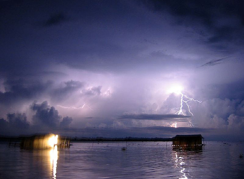
Venezuela's Everlasting Storm

The mysterious "Relámpago del Catatumbo" (Catatumbo lightning) is a unique natural phenomenon in the world. Located on the mouth of the Catatumbo river at Lake Maracaibo (Venezuela), the phenomenon is a cloud-to-cloud lightning that forms a voltage arc more than five kilometre high during 140 to 160 nights a year, 10 hours a night, and as many as 280 times an hour. This almost permanent storm occurs over the marshlands where the Catatumbo River feeds into Lake Maracaibo and it is considered the greatest single generator of ozone in the planet, judging from the intensity of the cloud-to-cloud discharge and great frequency.

The area sees an estimated 1,176,000 electrical discharges per year, with an intensity of up to 400,000 amperes, and visible up to 400 km away. This is the reason why the storm is also known as the Maracaibo Beacon as light has been used for navigation by ships for ages. The collision with the winds coming from the Andes Mountains causes the storms and associated lightning, a result of electrical discharges through ionised gases, specifically the methane created by the decomposition of organic matter in the marshes. Being lighter than air, the gas rises up to the clouds, feeding the storms. Some local environmentalists hope to put the area under the protection of UNESCO, as it is an exceptional phenomenon, the greatest source of its type for regenerating the planet's ozone layer.


If you like this post just click here Posted By crkota with No comments

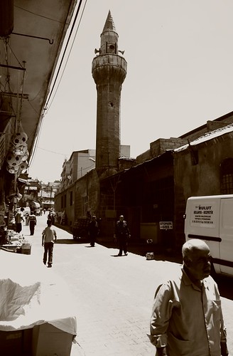
Gaziantep, Turkey


Gaziantep is one of the modern provinces of South-Eastern Anatolian Region and also one of the oldest of Hittite origin. Being the center of pistachio nut cultivation in Turkey and with its extensive olive groves and vineyards, Gaziantep is one of the important and industrial centers of Turkey.

The old city known as Aintap is located 12 kilometers to the north of the present city, on the upper slopes of Nizip Hill. The area was continuously inhabited starting from the Paleolithic age and witnessed the domination of such powers as the Assyrians, Persians, Romans, the Byzantines, Abbasid and the Seljuk Turks. The times of ascend for the Ottoman Empire meant the same for the city. There are many mosques, inns, baths and medresse built during this time.

Original builders of Gaziantep Fortress are not known. The fortress was restored by the Byzantine in the 6th century. The fortress was later saw restoration again in 1481 during the time of Kayitbay, the Egyptian Sultan, and in 1557 during the Ottoman Emperor Suleyman the Magnificent. The fortress was supplemented by watchtowers, mosques and small palaces. There are 36 watchtowers in walls which have a circular shape for 1,200 meters. Mehmet Gazali Tomb, a mosque and a bath exist in the fortress. It is believed there are galleries and paths leading to the river under the fortress. The fortress was an important rampart in resistance against the French during the War of Liberation in 1921.

Hasan Suzer Ethnography Museum building in Hanifioglu street remaining from the early 20th century was restored and transferred to the Ministry of Culture by a businessmen named Hasan Suzer. The museum simulates the old style of life by decorating its rooms with traditional furniture and by using models. The museum also includes various weapons, documents, instruments used in the defense of the city as well as the photographs of local resistance heroes.

Yesemek Open Air Museum is near Islahiye District, in the village known by the same name. It is the largest open air sculpture workshop in the Near East. It is a sculpturing school, reflecting all stages from the extraction of stones from the quarry to preliminary carving and to the final work. Investigations in the area reveal that the site was functional around 1375-1335 BC when the area was taken by the Hittites and the Hittite King Suppilulluma started to employ Hurris, the native people of the area in quarries. Excavations unearthed a rich collection consisting of sphinx and sculptures of lions, mountain gods and various architectural pieces. In the past, relieves prepared here were sent to such centers as Islahiye, Zincirli and Sakcagozu for final works and completion. The Yesemek Tumulus is located 2 kilometers to the west of the village. It is believed that it was a settlement inhabited by masters working here during the late Bronze Age and the time of the Romans.

Rumkale settlement is located at the point where Merziman brook joins the Euphrates (Firat) river. It is estimated that the settlement dates back to 840 BC and was built by the Hittites. Rumkale later lived under the domination of the Assyrians, Meds, Persians, Romans and the Arabs. It is said that St. John, one of the 12 apostles of Jesus, tried to spread Christianity in the region by using this settlement as a base. Rumkale is the largest of all fortresses in the area and it has many other remains dating back to various periods in history.

Karkamis district of Gaziantep used to be an important center of the east in the Antiquity (then known as Cerablus). The town is located on the Syrian border, the citadel and the inner town on the west side remaining in Turkey, and the outer fortress and town remaining in Syria.

Being an important centre of arts and culture in the past, Karkamis is the setting where the Legend of Gilgamesh took place. Many valuable pieces of art originating from this town is exhibited in museums around the world. At present, one can observe the remains of antic city walls, the temple and Hilani style houses. The temples of Hittite gods Tesup and Hilani maintain their striking features.

The remains of the old city of Belkis (Zeugma) are located in Kavunlu village 10 kilometers away from Nizip district. These remains appear as a tumulus type high acropolis dating back to the Hellenistic, Roman and Byzantine times. The old city is among those which issued coin on their name. Recent excavations revealed a room which is believed to be a part of an old Roman House as well as a mosaic belonging to Dionysos. Sculptures obtained from these ruins were exhibited at the Belkis/Zeugma part of Gaziantep Museum. But on June 2005, 2nd largest mosaic museum in the world (1st is the one in Bardo/Tunis) is opened in Gaziantep displaying 35 pieces of unearthed mosaics and Mars statue from Zeugma. Until this one opened, the mosaics museum in Hatay (Antioch) was the most important one in Turkey.

Dulluk which is close to the city center is ideal for those who would like to rest in a natural setting amidst forest and has camping facilities.

Houses of Gaziantep mostly found in the central town and Sahinbey are the finest specimens of a rich cultural heritage. They have traditional architectural features peculiar to Southeastern Anatolia, Mesopotamia and Syria. The finest examples of the old city fabric can be seen in the area around Hidir and Harap Mescit streets. Built in conformity with the climate of the area, the houses of Gaziantep are adjacent to each other along the narrow streets of the old city. These stone built houses surrounded by walls have their inner yards, smooth roofs with dead basements. Doors and window cases present some fine examples of woodwork.

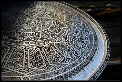
Gaziantep is famous for its three regional specialties: 1) The copper-ware products. 2) The delicious lahmacun (a kind of pizza in Turkish Cuisine) . 3) Sweet pastry baklava, which Gaziantep makes the best in the world.

The Gaziantep kitchen has a special influence on the Turkish cuisine with its immensely rich flavor. In addition to dishes which date back to the Oguz Turks, there is the influence of Aleppo. Its rich kind of soups, rice meals, kebabs, meatballs, etc. are among the most favorite. Local desserts include baklava, kunefe, burmali kadayif, sari burma, mashed pistachio and milk fat.

Inns are the symbols of the past economic and commercial richness of Gaziantep. They are still functional today as trade centers. These include Sira Hani, Kumrulu Han, Yeni Han, Kurkcu Hani, Anadolu Hani, Incioglu Hani, Tuz Hani and Haci Omer Hani.

There are two bazaars which could survive to our day and are still used. One of them, Zincirli Bazaar, was built in the 18th century. The bazaar is locally known as "black steps bazaar" and has 80 shops and five gates. The other bazaar, Kemikli, dates back to the 19th century. It is a cut stone and rectangular structure with two gates.

Gaziantep bore the influence of many civilizations for its location as a crossroad between the east and the west or between the Eastern Mediterranean and the plains of Mesopotamia. Coppersmith works, mother of pearl working, traditional shoe making, cloth making, stone working, antique weapons, gold and silver works are the leading traditional handicrafts in Gaziantep.

Gaziantep has a territory of 7,642 square kilometers and a population of 1,127,686 (1997). It is the leading province of the GAP region in terms of population density. It has 9 administrative districts: Sahinbey, Sehitkamil, Araban, Islahiye, Kargamis, Nizip, Oguzeli, Yavuzeli and Nurdagi.

Gaziantep is the most developed city of GAP in agriculture, industry and commerce. It has its pistachio known by the name of the city. Vineyards and olive orchards are also important. Manufacturing activities in Gaziantep are mainly carried out by small scale enterprises. As a vivacious industrial and commercial center, Gaziantep has cement, textile, leather, shoemaking, soap, woodworks, metal and machinery industries and workshops. It maintains its status as an "export gate" by its 120 different products exported to 40 countries.


The Gazianten district from an historical geographic point of view has a North Syria-Anatolian (Asia Minor) culture somewhere between east-west, situated on military and trade routes as well as being a crossroads, in today's Turkish Geopolitical make-up is still an important factor. For this reason, almost all cultures from the historic ages have influenced the Gaziantep district which has more than 250 mounds, which were first formed in the Neolitic age by the collective gathering of items from settlements reflecting culture and architectural advancement levels with each level belonging to a town, village or settiement. The oldest Anatolian findings attributed to man were some stone tools found in the DQllik Paleolitic cave, dated 600 thousand years ago, in the mid-Paleolitic age cultural life, especially from the Bronze age, Gaziantep and its environs shows signs of being a bustling settlement. This region was active in the Hum, Hitite Empire, Late Hitites, Assyrian, Persian, Hellenistic and Roman periods. Along with the Byzantians and Islamic periods, the Crusades of the Middle Ages brought new geopolitical forces and made Gaeiantep the scene for many historic events. The Gaziantep Museum has had more than 35 working sites for joint efforts and rescue digs, as well as scientific digs with all artifacts now located in the museum. In 1998 the Director of Museums sponsored 11 archeological digs usually with the assistance of the Gaziantep Museum and a total of 64 thousand artifacts were discovered.

The Gaziantep Director of Museum is responsible for the Archeological Museum, Etnographical Museum and the lslahiye Yesernek Open Air Museum. The Director of Museums is also responsible for 693vimmovable (parmanent) culture location and 221 archeological site areas. In 1944 Sabahat Göğuş gathered artifacts from here and there to establish the uaziantep Museum. First housed in the Nuri Mehmet Pasha Mosque, they were brought to this building in 1969. In a short time the museum needed to be enlarged due to the richness of the archeological potential of this location. 1976 saw the start of an additional ha!! and after standig half-completed for a lono time. it was finished and increased the museum space greatly. The buiiding today has 5 exhibition halls that remain humble beside the exhibits presented from f all the afore-mentioned sites.The Gaziantep Museum while trying to break I out of image as an historical depot and awake visitor sympathy tried to target new exhibitions.

MUSEUM HALLS

A. Temporary Exhibits and Nostalgic Displays

The long narrow hall at the entrance is usually used for temporary or periodic exhibits that change regularly. To attract those individuals who like pictures and chacterizations, a characterization exhibit, entitled 'Archeology' was held.

B. Chonological Hall

In this hall, Anatolian and Gaziantep's antique settlement locations and excavation centers are displayed on large panel maps for knowledge and there is also a chronology of Gaziantep's district. The first is of the natural history, especially the DillUk and Euphrates paleolittc stone tools, the techniques for their usage, didactic materials continue the display. Various CalcolMc and Bronze Age stages are displayed. The Iron Age and its shining example of civilizalion, the Urarians, are the last display. The second section contains, Acamedian-Persian, Hellenistic and Koffimagene with special Roman age artifacts placed in the display. The next section displays the decorated cups and various oil lamps of the Byzanliunti and Islamic periods bring this exhibit to a close. Also located in this hall is the Belkis-Zeugma Excavation 'Findings and Childhoods Toys of the Ages' display. There are also the bones of a mammoth and a stuffed crocodile on display.

C. Bellas-Zeugma Hall

Another long narrow hall displays the findings of the Belkis excavations on-hand and especially the carved gravestones and reliefs along with mosaic panels. (The 4th century A.D. graverooms with corridors and terraces with statues reliefs of the deceased are a special feature of the Zeugma necropolis.) Also displayed here was iliegally removed from our country in the '1960's by the United States of America.
Recently arranged according to modem museum standards, one side displays artifacts from all ages of bronze, there are the superstitous smail statuettes of people and animals, cult artifacts, figures, stamps and cylindrical signets, decorated needles, bracelets and tork's with fibula's, ring stones and classic-age hair signet presses with gold and silver ornamentattons. The other side holds the coins according to their pressage (minting) and period with notes about each period and special coins on the panels. The displays on the side contain gold, silver, and bronze coins from Greek, Hellenistic, Roman, and Byzantium periods beside Ottoman ornaments for the visitor to admire.
In the corridor joining this hall with the BeltasZeugma Hall, on two antique wooden buffets is a collection of "Old Gaziantep Children's Toys" restored and donated to our museum by Mrs. Akten Koyluoglu.

E. Exhibition Hall

This hall, again a first for our country's museums, displays a 60 panel panorama of "The founding of a Roman Period City' with a drawing exhibition area. •Turkish Architectural Works' and 'Archeologic Cultural Wealth' with 'Plundered Anatolia' were large photographic panels originalli/ sponsored by the Cultural Ministry and sent for display in many foreign countries, we have on display their reduced size copies. The Museum Director's 1997-98 excavations in the dam area of an Old Bronze Age Necropolis uncovered 312 gravesites and many remains and artifacts were taken More than 34 thousand signet presses which were uncovered at the Belkis-Zeugma excavations, now a panels display documents and information on local treasures illegally taken out of the country and current.

F. Museum Garden

In the front garden are funeral banguet reliefs and markers of the Hitite and Late Hitite periods. The -side garden is mostly occupied by finds from the Roman period at Belkis-Zeugma with men represented as eagles and women by wool basket motifs on the grave displayed in the garden. New large rock and stone artifacts and mosaic panels will be displayed in the new building upon completion due to lack of current space.

If you like this post just click here Posted By crkota with 1 comment
  • Popular
  • Categories
  • Archives